- non-plan_insights
- Posts
- non-plan_insights: Issue 01
non-plan_insights: Issue 01
Lessons from the AEC Hackathon – How Open Data Can Transform Zoning Analysis
Editor's Note
Welcome to the first edition of non-plan_insights — our space for thoughts, tools, and takeaways around open-source innovation and digital workflows in the AEC industry.
We start this journey with a look back at the AEC Hackathon 2025 – Zurich Edition, where we developed a zoning feasibility tool using actual zoning data from the City of Zurich. What began as a weekend sprint opened doors to real-world impact—and revealed the urgent need for better zoning tools in Swiss architecture.
What We Built: OpenPermit
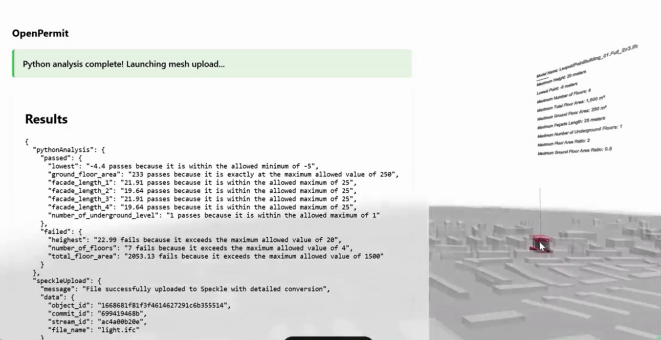
At the Hackathon, we developed a prototype called OpenPermit—a tool designed to let architects upload an IFC model and instantly assess zoning feasibility based on the urban context.
Our proof of concept combined:
IFC model input
Zoning geometry from the City of Zurich (in SHP format)
Automated logic checks via scripted rules
A simple interface that gives instant feedback on volume and placement
The goal was to turn early-phase feasibility into a faster, smarter, and more visual process—without waiting weeks for feedback.
Starting Local — Zurich’s Data is an Opportunity
For the demo, we worked with a shapefile provided by the City of Zurich—a clean, machine-readable zoning dataset available through their open data portal.
This allowed us to automate several processes:
Matching IFC site placement to zoning zones
Estimating maximum volumes and allowed usages
Flagging obvious rule conflicts based on geometry
The process showed enormous promise for developing Grasshopper plugins and web-based feasibility tools that could speed up design iterations and reduce friction in regulatory interpretation.
Scaling the Idea: Lessons from the ARE (Bundesamt für Raumentwicklung)
After the Hackathon, a client approached us asking whether such a zoning feasibility system could be adapted more broadly across Switzerland.
We began exploring—and quickly encountered a core issue.
We reached out to the Federal Office for Spatial Development (ARE), and their answer confirmed what many already know:
“Zonenplanung is governed at the cantonal level. The harmonized ‘Bauzonen Schweiz’ dataset provides only a basic, generalized view across cantons. Actual rules vary by region, and coverage is still incomplete.”
Even though there’s a harmonized federal dataset, it only includes broad zone types (e.g. residential, commercial). Most detailed local zoning logic—like floor numbers, setbacks, and usage rules—are determined at the cantonal or communal level.
But here’s the upside:
Some cantons (like Zurich) already share detailed zoning maps in shapefile format
Others are catching up, often through platforms like Geodienste.ch
Open formats make it possible to automate, visualize, and even simulate zoning logic—especially when paired with tools like Grasshopper, Speckle, or custom Python scripts
This is not a dead end—it’s a roadmap.
Why This Matters
The insight is simple: we can’t keep handling zoning feasibility with manual drawings, guesswork, or vague PDFs.
Architects lose valuable time during early design because zoning information is hard to access, inconsistent, or buried in legal documents.
Such a tool could:
Provide instant feedback on zoning limits for a parcel
Visualize design constraints directly inside 3D tools
Save weeks of back-and-forth during feasibility studies
Help young architects and students better understand the rules
Support urban-scale simulations and what-if studies at a city level
And the biggest benefit: it doesn’t need to be exclusive.
Let’s Build It Together
There is already market interest—several architectural firms have inquired about the development and integration of such a tool into their workflows. They saw the value—but also recognized that developing and maintaining it alone would be too much.
That’s why we believe this belongs in the open-source construction ecosystem:
Shared effort lowers the development barrier
Transparency builds trust in how zoning logic is implemented
Community maintenance encourages better documentation and updates
Public funding or consortium models become possible
This is the kind of tool that belongs not in one office—but in every architect’s toolbox.
Thanks and Credits
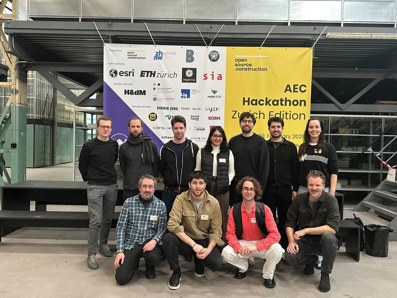
Thanks to the Hackathon team that made OpenPermit happen:
Duhan Koyuncu, Niloofar Imani, Alp Okan Atakan Kural Avgören, Emanuele Mastaglia, Nickolas Maslarinos.
To ESRI: thanks to Arno Fiva, Taisha Fabricius, and Thorben Westerhuys for your insights navigating geospatial tools.
To OpenSource.Construction and Maximilian Vomhof — thank you for pushing open innovation forward. We’re proud to now be contributors.
To Björn Steinhagen at Speckle — thank you for helping wire it all together, from Python to Grasshopper.
We Want to Hear From You
Have you tried automating zoning studies?
Would your team use a tool like OpenPermit?
Could you contribute with data, logic, or funding to help us build the next version?
Let us know — or join our working group via Discord
We’re drafting the future of zoning, one script at a time.
Till next time,
Mikel Martínez
non-plan
Reply